Feature and Level Survey
Helpful Tip – A Feature and Level Survey is commonly completed at the same time as the Title Re-establishment Survey. Completing these surveys together can provide you with a significant saving. Chat with the helpful team at Linear Land Surveying today for more information about completing these surveys together.
Before starting any land development project, the necessary first step in the process is the completion of a Feature and Level Survey to accurately assess the existing site conditions.
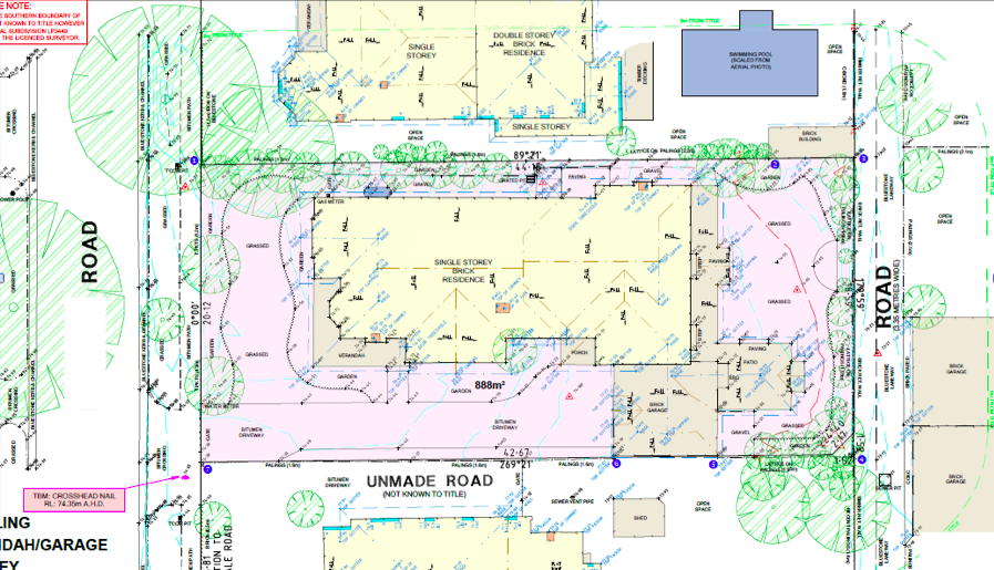
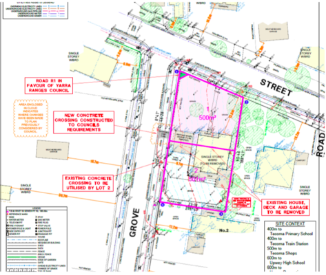
Feature and Level Surveys provide a detailed view of the existing site conditions of the subject site, locating all topographical features of the property, as well as details of adjoining properties and the street. Our Feature and Level Surveys provide sufficient level of detail for local councils and town planners to accurately assess the potential impact of any changes to the property.
Depending on the scale of the project, Feature and Level Surveys may be required as part of any Planning or Building Permit Application.
What our Feature and Level Surveys show:
- Spot levels and contours over the site.
- Significant features and visible services over the site.
- Significant trees (including trunk/canopy size) over the site and near site boundaries.
- Location of existing site building, garage/sheds including a floor level and levels on eaves, ridges and gutters.
- Location, type and height of all boundary fences or walls.
- Location of directly adjoining buildings, including set-backs and levels on eaves, ridges, parapets and gutters.
- Location of overlooking windows within 9m of site boundaries including head and sill heights and noting if they are habitable/non habitable.
- Location of neighboring buildings within 9m including gutter and roof heights.
- Road details including natures strip detail, visible services & crossovers directly in front of the site.
- Establishment of a TBM on or near the site.
- Survey connection to the nearest registered Australian Height Datum (AHD) bench mark.
We are happy to tailor our survey to suit your specific design needs.
Linear Land Surveying prides itself on its detailed and cost-effective Feature and Level Surveys, completed utilising the best available contemporary surveying technology. Call us to day to receive your free no obligation quote.
Frequently Asked Questions
You might need to complete a Feature and Level Survey for many reasons.
Most often, Feature and Level Surveys should be completed when you are planning to build (either a new build or extension/addition) on your property and when you are developing your property, for example through subdivision. The survey will be used in both the planning and development stage of your project by councils and authorities, architects, and builders.
Other times when you might need to complete a Feature and Level Survey include more specific scenarios, such as when issues arise over flood levels and drainage needs to be checked.
Linear Land Surveying are happy to tailor our survey to suit your specific design needs. However, a typical Feature and Level Survey will capture the spot levels and contours of the site and establish a TBM. It will also identify built features and visible services, significant trees (including trunk/canopy size), and the location of existing buildings, including set-backs and levels on eaves, ridges, parapets and gutters. Furthermore, our surveys will capture the location of overlooking windows and neighbouring buildings within 9m of site boundaries.
Your Feature and Level Survey will also identify road details including nature strips, visible services and cross-overs directly in front of your property. Chat with the team at Linear Land Surveying today to determine if a Feature and Level Survey is right for your project.
Feature and Level Surveys will generally capture several features of neighbouring properties.
Specifically, Feature and Level Surveys will capture the location and height of all boundary walls and fences along with any adjoining buildings, including set-backs and levels on eaves, ridges, parapets and gutters.
Furthermore, the location of gutter and roof heights of neighbouring buildings within 9m of boundaries will be captured. Your survey will also detail the location of overlooking windows within 9m of site boundaries, including head and sill heights, while noting if they are habitable or non-habitable.
A Feature and Level Survey provides detailed information about the land and features of your property.
The Feature and Level Survey Plan is therefore a vital piece of information for any architect or developer in the design stage of a project. The survey information and plan are also used by builders and other developers to plan and work efficiently on the site. The survey will also be utilised by council and related authorities when reviewing your proposed development.
Accurately capturing the details of your property prevents delays and costly mistakes and can maximise your development’s design and land use by having all the up-to-date and essential site information.
The duration of a Feature and Level Survey will be determined by the size of your property and complexity of the features present.
Typically, urban residential properties can expect a team of two field surveyors onsite for approximately half a day to a full day for the capturing of feature and level data.
The team will then require 1-2 days of drafting to complete the final Feature and Level Survey plan.
Chat with the team at Linear Land Surveying today to organise a Feature and Level Survey on your property.
At Linear Land Surveying, we use a range of the latest technology to accurately capture the features and levels of your property.
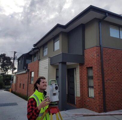
We utilise Leica Total Stations which employ a theodolite and an electronic distance meter to measure angles, distance, and slope.
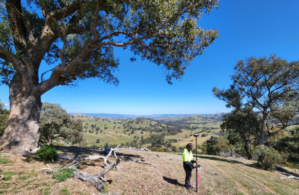
On larger properties, we also utilise GPS and drone technology to capture data on a greater scale.
These technologies are highly accurate and are always confirmed by manual checks and measures. Our team can accurately capture data on your property within 10mm.
Our team takes pride in the careful drafting of our survey plans. We have been praised by both architects and developers for our detailed and clear plans.
On completion of our field work, your Feature and Level Survey data will be presented in a Survey Plan supplied in both AutoCAD and PDF format. We can also produce 3D output of survey data with contours and triangles if required
A Feature and Level Survey is typically a survey of focused on the land properties of singular development site and can include the building and overlooking windows within 9m of surveyed site boundaries.
A Site Analysis Survey (also known as a ResCode Survey, Site Description and Site Context Plan) will assess the features and levels of a site but will also capture data in a much wider survey area, providing greater context for the primary property’s development.
These surveys are an essential step in the subdivision process and provide more information with respect to Clause 56 of Council Planning Schemes. These surveys can capture a range of data including but not limited to; roof information of buildings in the area, building details and vehicle access points in the area, fencing types and heights surrounding the property, setback information and the proximity of the property to nearby public open space, community and recreational facilities and public transportation.
An AHD Level Survey is a Flood Level Survey that determines the height of a given area of land in relation to the Australian Height Datum. The Australian Height Datum refers to the elevation of any object relative to a reference point.
In Australia, the reference point used is sea level, which is taken as 0 metres in the AHD. All flood levels, floor levels and ground levels are provided in meters AHD.
Many people will opt to get an AHD Survey conducted at the same time as a Feature & Level Survey.
Chat to the Linear Land Surveying team today to discuss if this is right for your property.
Need help with Feature and Level Surveys?
Submit your enquiry and one of our specialists will get in touch shortly: